Lahontan set out from Michilimackinac on September 22, 1688, accompanied by his “own Detachment” of at least ten or twenty men (perhaps more), and the five seasoned Ottawa hunters “who indeed did me a great deal of Service.” He returned 240 days later, on May 22, 1689. By May 28 he had drafted a lengthy though hasty report to his patron, “Containing…the Journal of a remarkable Voyage upon the Long River, and a Map of the adjacent Country.” This is the much-disputed “Letter XVI,” first published in French and in English in 1703. “THANK God,” Lahontan began, “I am now return’d from my Voyage upon the Long River, which falls into the River of Missisipi. I would willingly have trac’d it up to its Source, if several Obstacles had not stood in my way.”
For the full story see The Mysterious 1688 Journey of M. Lahontan. Discussion Paper by Prof. Peter H. Wood (Duke University), for April 2007.
LOM D’ARCE DE LAHONTAN, LOUIS-ARMAND DE, Baron de Lahontan entry from the Dictionary of Canadian Biography. This source says he departed from Michilimackinac on September 24, 1688.
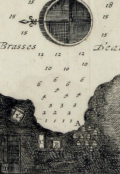
Detail of a map of the Straits of Mackinac by Captain Louis-Armand de Lom d’Arce de Lahontan, Troupes de la Marine, 1703. This is the mission of St. Ignace and Indian villages. A) French Village; B) Jesuits’ House; C) Huron Village; D) Fields; E) Ottawa Village.
 |
|
Map by Lahontan from 1687-1689, from the 1703 English edition. The two primary routes between the St. Lawrence settlements and the various interior posts were represented, passing via the Ottawa-Mattawa-French Rivers to Georgian Bay of Lake Huron, and via the upper St. Lawrence River and Lakes Ontario (Frontenac) and Erie. In addition, the officer also portrayed the passageway which extended between Lake Ontario and Georgian Bay, by way of the Toronto Portage route. His depiction of the water passage between Montreal and the New York-New England region, via the Richelieu River, Lake Champlain, and the Hudson River, emphasized the military and commercial traffic which passed along that route as well.
|